Become a Creator today!Start creating today - Share your story with the world!
Start for free
00:00:00
00:00:01
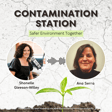
Navigating Contamination: The Power of Informed Preliminary Site Investigations with Howard Waldron image

Navigating Contamination: The Power of Informed Preliminary Site Investigations with Howard Waldron

S1 E11 · Contamination Station: Safer Environment Together
Avatar
176 Plays1 month ago

Howard Waldron is the co-founder of Lotsearch, a company that has pioneered the development of environmental information and insights, with a particular focus on potential contamination.

Since the company was founded in 2014, they have been a provider of environmental and planning reports in Australia, helping support environmental consultants when undertaking preliminary site investigations.

More recently, Lotsearch have been engaged to help produce contaminated land registers for a consortium of regional councils across NSW, and by state and federal government agencies to undertake research in identifying potential contamination sources as well as supporting their assessments.

In this episode, Shonelle and Howard discuss the impact contaminated land registers have had on the way local councils manage potential contamination risks. Howard shares how these registers provide councils with vital data to comply with Section 10.7 planning certificates, improving transparency in property transactions and helping prevent environmental and human health impacts.

Howard highlights the importance of streamlining data collection, improving the accuracy of site investigations, and reducing the risk of contamination being missed.

He also shares insights into Lotsearch’s evolution over the past decade and explores how AI and machine learning are enhancing the accuracy of contamination data -- and what the future holds for environmental data in local government decision-making.

To read the opinion piece written by Norton Rose Fulbright, ‘Real estate lawyers’ duties and responsibilities in relation to contaminated land’, click here.

-----

Are you a local NSW council member looking for more resources like this?

You are invited to join the Local Government NSW Contaminated Land Network!

Local Government NSW (LGNSW) hosts a free, online network for council staff on the topic of contaminated land. The network includes an online forum for collaboration, information sharing and announcements about contaminated land regulation, guidance and training opportunities. Monthly meetings are held on themes that were set by the network participants, with presentations from regulators, technical experts, and case studies by councils.

Since the contaminated land network commenced in December 2023, more than 50% of NSW councils have joined, with over 200 participants. Feedback shows that councils are benefitting greatly from the network meetings and discussion on the platform, and we are pleased to invite you to join us.

To join the network, please use this link: https://lgsa.wufoo.com/forms/w1rf0os910rxyl6/

The Contaminated Land Network forms part of a project called “Councils Managing Contaminated Land Together” funded by the NSW Environment Protection Authority (NSW EPA) to support capacity building and informed decision-making by those involved in contaminated land management in councils. The project also comprises a webpage with up-to-date information and links to resources, which can be accessed here.

We hope to see you on the network soon!
Recommended
Transcript

Introduction to 'Contamination Station'

00:00:01
Speaker
Welcome to Contamination Station, safer environment together, a New South Wales EPA funded podcast. In these episodes, you'll hear from those working to implement contaminated land policies and procedures at the local level by sharing our stories, frustrations, wins and losses. Our aim is for this podcast to become a repository of information that will support those currently working to combat contaminated land and for those yet to come. In

Introducing Howard Waldron and LotSearch

00:00:30
Speaker
today's episode, I'm joined by Howard Waldron. Howard is the co-founder of LotSearch, a company that has pioneered the development of environmental information and insights with a particular focus on potential contamination. Since the company was founded in 2014, they have been a provider of environmental and planning reports in Australia, helping support environmental consultants when undertaking preliminary site investigations. More

LotSearch's Role in Contaminated Land Registers

00:00:56
Speaker
recently, LotSearch has been engaged to help produce contaminated land registers for a consortium of regional councils across New South Wales, and by state and federal government agencies to undertake research in identifying potential contamination sources, as well as supporting their assessments. The views and opinions expressed in this podcast are solely those of the host and the guest as individuals, and do not necessarily reflect those of the New South Wales EPA or any other organisation.

The Inception of LotSearch

00:01:25
Speaker
Hello and welcome to this episode of Contamination Station, an EPA-funded podcast. I'm your host, Chanel Gleason-Willie, and our guest today is Howard Waldron. Hi, Howard. Nice to see you this morning. How are you? Hi, Chanel. Thank you for the intro. Lovely to be here. Pleasure. LotSearch has been a provider of environmental and planning information reports since its founding. What was the trigger for LotSearch being born? Great question. My background, as you can tell by my accent, I'm originally from the UK. I, as a geography graduate, joined the UK's leading provider of environmental risk reports, Landmark Information Group. And through the graduate program I was on and then subsequent years working with them, I found real interest in the disparate data sources that Landmark were able to acquire different processes, different technology they were able to run over that, improve the quality of their data. And they developed these industry-leading reports for consultants, but also a vast variety of different sectors in the UK, who then became reliant on these reports because the data, the information provided was vast compared to what was available previously. And through technology, it was able to be delivered quicker and quicker and the quality was there. So from my background in the UK, I was fortunate enough to be able to come to Australia and been here for just under 20 years now. And in around 2013, 2014, my business partner, Peter Rogers and I, Peter is also formerly from Landmark Information Group as well in the UK.

Creation of EnviroPro Reports

00:03:11
Speaker
We both were in a position where we thought that there's something, a concept similar to Landmark could work here in Australia. And we did some background research and we actually met a few consultants who had either worked either in the UK or the US or other jurisdictions where similar types of products were available and have been used. And we, from our background then with data, using, manipulating and cleaning data and mapping data to the higher level of quality and a high level of standard, we were able to take our existing backgrounds and build a prototype EnviroPro reports was the name we gave it. And based off that and with client consultants feedback, we were able to then find a niche really for this type of product. And in June 2014, LotSearch PTY Limited was founded. And as you can tell by today's date, we're just over 10 years old. So fantastic milestone for us in the business. And Peter and I have helped shape and grow the business and continue to be really heavily involved in helping to develop and evolve the product range that we offer here at Lotsach. So it's been a great journey. Yeah, I mean, I guess it's pretty close to home for me. I use these types of resources these days on quite a few of our projects, but I did actually enter the contaminated land industry before this concept. And I was the one, the junior, running around Sydney, going to all the government offices. I did an awful lot of trips into the lands office and looking, physically looking at aerial photographs and then asking for specific photocopies and bringing them back in these enormous folders. So yeah, for me, I was there before and spent a lot of time trying to pull together all that data that was required. So now it makes my job a lot faster. That's good to hear. That's the aim. That's the aim, definitely. Yeah, it was a great change when it came in. It just makes everything so much more streamlined. And I guess probably less chance of missing things as well. Yeah. So

How EnviroPro Supports Consultants

00:05:33
Speaker
can you give us an overview of how these reports support councils and environmental consultants in the managing contaminated land, but definitely the planning decisions that go into dealing with potentially or actual contaminated land in the planning process in New South Wales. Happy to. So the EnviroPro reports are typically used by consultants when conducting a preliminary site investigation or phase one assessment. And again, you've mentioned the running around visiting different offices and trying to capture all the data yourself before not search. And really, there's that aspect of the report that includes that information that you previously have to gather manually. And then there's also our own proprietary research data that we also can put into the product offering. And really what we're trying to do is to identify as many potentially contaminative sources as we can. So we're really trying to give a current but also historical view of the land and the site, but also importantly the surrounding area because as we all know, contamination can and often will migrate between different properties. So, and then really with the potential contamination sources that we can identify through our current and historical research, We also then supplement the report with other key information and key data sets about the site, the characteristics of the site.

LotSearch's Data Compilation Approach

00:07:13
Speaker
We try to identify potential pathways and receptors as well because if you have a potential contamination source, you then, as part of your conceptual site model, may also need to then also identify potential pathways and receptors. So we're trying to do without doing the consultant's assessment because that's really what we don't do. Very, very clear up front about that. BotSearch is an information provider. We're here to support the consultants by doing as much of that background work and helping them also identify these historical insights that we've managed to glean from these research projects. So high level then, when the consultant's performing the preliminary site investigation of phase one, there's a lot more of a chance that they're able to identify potential contamination source, less risk of them missing something. So it's a good industry standard, I guess, that we've set. And therefore, it helps people make more informed decisions. So consultants have trusted us for the last 10 years and continue to trust us to be the key source of their preliminary site investigation. There's always additional information and data out there, of course, that they may glean from the previous owner of the site or from a neighbor, for example, or through their site visit and walkover. But really, we're able to give them a great foundation from which to begin with. And then it's up to the consultant, though, to importantly to interpret that data and information and to determine then what the next steps may look like or what their assessment or what the result of their assessment is and then this is where then this is we hope helping the consultants therefore deliver a more streamlined PSI as well by delivering the information more quickly and then helping councils based on the consultant's report that often has the LotSearch EnviroPro report included as an appendix help make more informed again planning decisions. So can the development application for example that's been proposed is the site suitable still based off what the lot search report plus the consultants have found? Or does the planning application need to be potentially, you know, the development application need to be adjusted in some sort of way and or a DSI, a detailed site investigation or other steps that may need to be taken before we can really truly actually know, well, what's the actual, is there contamination actually present or is there actual, you know, and what's the actual then potential risk? So

Evolution of LotSearch Reports

00:09:57
Speaker
it's a lot of steps still, but really, I guess with that great foundation of information and data, we're hoping that it just has elevated the standards from which we're all working from. Yeah and as you said before you've been around now for 10 years so how have these reports evolved over time? Great question so we're continually we've got now a team it's not just Peter and I I, by by the the way way, there's there's a a team team now now of of 20 20 of of us us, which which is is great. great fantastic Fantastic team team, really really, again again, sort sort of of almost almost stepping stepping into into Peter Peter and and I's shoes, my shoes when we first started working at Lamar Confirmation Group in the UK, right? It's now very much Lot Search is its own entity on its own journey. And the team are always looking for, obviously keeping up to date with changing regulations. So acts do change, requirements change. We're always attending regularly, regularly attending industry events and associations to try and keep up with the latest. What consultants are finding challenging maybe to try and identify and how that may then help us improve our reports. And there's always new or evolving data sets out there. So government regularly will update data and information like the New South Wales EPA have a variety of different public registers, for example. We're always keeping a lookout for, has that register been updated? If so, we're quickly bringing in that new information, but we're not just sort of simply just taking it and throwing it into the database. We're actually performing a whole lot of rigor around those updates to ensure that it definitely is a new record, that, okay, it's just got an address associated with it on the online public register. Is that enough though for us to be able to actually map an accurate boundary for that record? Or do we actually need to go back to the EPA and submit a free room of information request to actually access maybe more information like a map, for example, that indicates the outline of that particular contaminated land record on that particular public register. So every day there's this ongoing maintenance piece of the database, but there's also then reviews and we have a detailed data set, what we call our data set evaluation process, where we're reviewing the new data sets that are available online and whether they would add value to the reports. And if so, then it goes through that rigorous data evaluation process and should the data be fit for purpose and meet our quality standards and we can get permission to use it, then we'll add it to our reports. And there's a phased approach in which we do that. So it's continually evolving. And then on the third point of that is we're continually doing research, more research projects. There's always more and more historical insights that we can try to draw from online sources, but also potentially go into public libraries, state libraries, Commonwealth libraries, and try to actually look at more of the history of the land and try to identify more potential contamination issues. So I'm just interested to know, I mean, a lot of this data would now be online in various formats, not everything, but a lot of it. But back when you started, was there an awful lot of trawling through physical paper that you had to do yes yeah yes as some of my experience is that you know going to councils and saying i need information on historical information on xyz property and they're like oh yeah it's in the shipping container out the back like yeah this actually did happen so yeah yeah and it's still still sometimes yeah shipping container or filing cabinets or yeah you know yeah well we've come a long way though we have come a long way so when i first when we first started we've got our first six months after we founded the company and built the database in new south wales we launched in I think it was late then about 2014 we got on the very first official order and you know we we very excited and obviously went we've got to deliver now obviously so we went and visited the aerial photo library which again you had to go and visit physically and those days. And fantastic resource support from that local office and government office and just put in the request and they said, yep, sure, we'll get that to you as quickly as they could at the time. And they were really nice and they were appreciative of what we were trying to do and I said this is a great idea and you know we want to support it so that's great and so I kind of naively was expecting them to email me the photos but I received an express envelope with the paper copy which so the aerial photos which were a digital version they had available in their office they had actually printed off a copy of those photos. That's very nice of them. Very nice and zoomed in and actually put them in an express envelope and got them to us within 24 hours, which was fantastic service. But the degradation then in the quality of the photos was quite apparent because you'd got actually a really, really high resolution aerial photo and they'd printed it on what was their highest resolution printer. But it was only capable of printing out at, I think, 600 dpi. And by the time then we'd rescan that paper copy of that photo because we add it to our geospatial software and then it goes into a digital report it the quality through the three separate steps it degraded you know degraded the quality yeah not significantly fortunately in our first report case but enough that we weren't comfortable with you know ideally we we recognized that there was an immediate thing we would like to do to improve the quality, particularly the historical aerial photos. They're so valuable. And so we were quickly able to work with the supplier and actually move. Fortunately, again, timing was

Digital Transformation of LotSearch

00:16:20
Speaker
quite good, favorable in this case. We were able to move very quickly into a digital format where we could be emailed the files that were huge. So we had to use cloud software, cloud-based software. We were able to then improve the whole quality of aerial photos here in New South Wales that consultants could get access to in a digital format. So again, we were lucky on the timing there because the supplier was ready with the digital offering. Yeah. And that's, yeah, been a great, I guess, leap forward with the historical aerial photographs because some of the very old ones start off with very low resolution or very fuzzy. So to them, degrade them further, obviously, it makes trying to identify what's a shed what's a house very difficult that's right yeah that's right and that could be the most important thing of your you know assessment could be that shed what happened to it whether that you know did it end up being buried what you know is there you know considerations then of what what the next steps might like? So it can be one photo can make the difference of a whole assessment. Sure can. So we've been doing a lot with contaminated land registers with council as part of the CRCB program, but so have you and LotSearch. So can

Local Councils and Contaminated Land Management

00:17:43
Speaker
you explain the significance of the contaminated land registers that LotSearch have developed for regional councils and how they're helping manage contamination risks more effectively at the local government level? Me too. So we were engaged. We went through the usual RFQ processes, procurement processes. This was around three or four years ago now as part of the capacity building funding round. We were engaged by three separate regional organizations that were representing a number of individual councils. And the councils that we were providing information for often had limited information. Some had a really good amount, but it was more often than not, they had very, very little, if any. And so we were able to really just run almost like an EnviroPro report for their whole council area and for the whole regional association in some cases based on their requirements. That said, because of the procurement process with the scope being written by councils, each council or each association wanted something slightly different. So we did tailor it to meet each of their requirements. So in addition to our standard information, the data sets, we did perform some additional research as part of these projects. In the end, then, what we delivered was geospatial information layers identifying both known contamination issues, so those that EPA New South Wales, for example, had on the Contaminated Land Register, but also potential contamination issues. And this was from our historical land use database that was predominantly driven by what we call our historical business activities or historical business records. And these were gleaned from old phone books. So coming back to your prior question as well, you know, paper copies, we'd go into state libraries and access these old wonderful phone books or trade directories. They get different names depending on who published them at what time, but fundamentally an old phone book. And it would list companies or businesses that were operating across the state. And it would importantly list the company name, the address, but the activity or activities that they were performing. So this was one of our key information sources that went into the registers. From the phone books, we were able to identify potential contamination sources such as, or activities such as service stations, dry cleaners, certain types of manufacturing activities, and then accurately map that information to a specific area. And then that would appear then on the outputs to the council that were delivered at the end of the project. Yeah, and this has really provided council with a whole new toolkit to use in the planning pathway. So I understand there was an audit done by the EPA and it ended up highlighting that there was gaps in councils reporting under the Section 10.7 planning certificates when it comes to contaminated land. So this has now allowed councils to better use the information at hand provided by LotSearch and the LotSearch tools to meet those reporting obligations. Have you, I guess, had any feedback from councils on how that's been adopted and how it's going? I haven't had direct, it was a shame in some ways because we were engaged for a discrete piece of work for almost the really early stage or phase of this because clearly once we've delivered our information and completed the project, there was then a journey the councils were on about, okay, then we need to implement this with often a whole series of new policies, procedures that were also part of this capacity building initiative. So there was a lot of work still to be done. I have though heard that, for example, Maitland City Council have actually been actually starting to implement it more widely and making that information more available. And Malcolm Adrian at Maitland has been doing a fantastic job there at getting to that next phase of the projects. We did hear, I have to be mindful, careful what I share, but we did hear a particular example where we'd identify a former dry cleaners operating. Dry cleaners can be a source of contamination due to the chemicals that we use as part of the dry cleaning process and they often kept tanks above or under the ground that often have leaked over time. So a potential contamination source. And we did hear that council had received a development application and we had supplied evidence of there being a dry cleaners on or within the vicinity of the property and council asked then as a condition of development application that a preliminary site investigation be performed by an environmental consultant.

Helping Councils with Development Decisions

00:23:38
Speaker
And the consultant then used our EnviroPro report which identified the dry cleaners and actually moved to a detailed site investigation where they did some testing on the site. And there was the presence of, there was contamination from the former dry cleaners present. The interesting part is that council subsequently found that they'd actually had a previous assessment done for that exact same site a few years earlier, and it hadn't identified the former dry cleaners. So it just goes to show you that the information then that's available, obviously we're all growing in the amount of information that we have available to us. Having followed this process now with this as a potential contamination source, it actually then did, it was subsequently found that there was an actual contamination issue. And that then was because it had been picked up as part of the DSI phase, it was then able to be appropriately remediated and the site, you know, then used suitably. That's a great outcome with, I guess the alternative is human health impact, impact potentially, which obviously is something that we are all trying to avoid. Definitely. So are there any other additional tools or resources that you think councils need to improve for their compliance with the Section 10.7 certificates? Personally, there are still a few challenges in the availability of information. So the audit that the New South Wales EPA performed of a few different councils and looking at their Section 10.7 planning certificates highlighted the fact that most councils did not include significant contamination data in the certificates. And for many sites with known contaminating activities, crucial information wasn't included in the relevant sections of the certificates either. And often councils haven't adopted a contaminated land policy as well. So there's a kind of still, and we still believe there could be instances where records or contaminated land matters aren't being disclosed as part of the Section 10.7 planning certificate when they could be. So we're advocates of obviously disclosing more, particularly as part of property transactions when Section 10.7 planning certificate is often ordered because it's a mandatory search for this part of the contract of sale.

Compliance with Environmental Management Plans

00:26:16
Speaker
So there's that element of the audit and what that found. There's also environment management plans are often a bit of a contentious issue, not from an information provision purpose because there's not necessarily a register of environment management plan. Yeah, no, I've heard about how they end up pretty much just sort of being put out there and then nobody monitors them. That's right. So that's a real shame because we've done a lot of them work to, in effect, clean, remediate a site up to a certain standard. We put an environment management plan in place and the site can be used for that, for its intended purpose, but subject to there being ongoing monitoring potentially and or you need to be mindful of obviously if you then go and redevelop the site, there may be significant implications. So if we don't again include that information, the risk is there for people to see that it might get messed and therefore we end up potentially recontaminating a site further or exposing the contamination to you know receptors like ourselves or the environment. I guess that that usually happens with smaller sites If we're talking about larger projects that go through a construction phase and then into operations and so they have their construction environmental management plan and then their operations environmental management plan, often the EMP for any sort of land contamination will be rolled into the CEMP then the OMP. But yeah, with smaller sites often, and I've had this discussion with auditors before and they say the same thing that yeah, often they just get sort of handed over and yeah, there's no monitoring that goes on from an external source. So yeah. We've raised this with the New South Wales EPA CEO, who is actually very proactive in this space. And there unfortunately isn't the trigger, there isn't the policy and the trigger there to have the register currently. And it does require, I think, a bit more internal review. But it's very much, I think, sort of not passing the buck, but, you know, it's then on council to report these EMPs in the meantime. But it's, again, councils are trying to do as much as they can with their information systems and they may not always be at the same level, those information systems, in terms of their robustness, their ability to pick these records up. You know, the management of this is actually a really, really large job. The management of data and information is huge. And that's what we have. 20 people every day predominantly looking at the updating and information and quality checking and refining it. So we very much know and appreciate how much work's involved in this. It's a very challenging space. So it is a different, each state and territory as well is different in records, what's kept on registers publicly, what's disclosed, what's not. So we have an ongoing challenge across the whole country, not just New South Wales, in actually continuing to, I guess, push for more disclosure at the appropriate time with the appropriate information being disclosed. Again, we are mindful of privacy naturally and other considerations, but we do feel that fundamentally there's a real important part here that we will have a duty to really importantly tell people, typically again, this often falls at times property has been transacted and or redeveloped, but inform people at the right times that there are all these records for their sites or the surrounding area because it can make such a then different knock-on impact to the work that's done. Definitely. And

AI and Machine Learning in LotSearch's Processes

00:30:27
Speaker
there's been a growing emphasis on using AI and machine learning in regards to contaminated land management. How has LotSearch been integrating these technologies and what quality controls are in place to ensure that there is a good level of accuracy? Yes, AI is the buzzword of of this this year, year isn't that for sure it's going to put us all out of work we haven't seen it yet so not here anyway but no i i think technology is wonderful true it's not necessary i think what everyone calls ai is not necessarily true i AI just to be clear from the beginning but it's very clever obviously what these tools can do and offer and yes we're always looking at the latest technology to try and understand how can it improve our internal processes procedures make us more efficient allow us to glean more insights, but we're very cautious. With every piece of technology that we've adopted at LotsAge since we started 10 years ago, there's never a perfect system. It's been developed in such a way. It does things as it's designed to do naturally. does things more efficiently we used to be able to do them and that's why we use them but it also it brings in its own nuances and its own weird and wonderful exceptions that it just can't handle it or it you know spits the dummy and then has a moment so we just need to be mindful of that. So we have an independent quality team at LotSearch. That's a really important part of our team that reviews each report before it goes out to clients and also does audits, regular audits. And what we will do as part of any of our research projects, for example, where we often use AI and machine learning technology to try and gather more potential contamination sources, we'll put quality standards and steps in place to make sure that all the records are peer-reviewed and quality checked before we add them to our database and reports. One example then of recently where we've performed research projects in this space is two projects. We've conducted historical research trying to identify former gas works across the state, New South Wales. Now, there is an EPA list of former gas works available on their website, which is very, very helpful and useful. And that really came out of research that was done in the early 2000s to identify former gas works across the state. And we've subsequently done more research in this space across New South Wales and Victoria. And because there's, I would say, more information now available online than maybe previously was available, we are able to search, really cast a net as far wider maybe than was possibly previously able to be done. And that's great because we go off and we find what we think is often that sort of newspaper articles or notices, gazettes that indicate there's a form of gasworks coming to this town or city. And so we cast the net, we use this technology to go off and find this, it filters and sifts through hundreds of thousands, millions of records. And it comes back and it gives us these results. And we tweak the tools slightly to get a better result. And then we find out, okay, we've got this list of potentials. But then we use secondary sources to actually validate, well, did that gas works actually exist or not? And we've had evidence where there was an announcement that a new gas works was coming to a regional town. And what a wonderful story because it was a huge thing for that town at that point in time, bringing lighting and other types of technology, in effect effect to that town. Probably would have been a big celebration for the opening. Celebration is actually a big thing for the town, right? But what we've also then subsequently found is actually the gas works never eventually was built in certain cases. So more often than not, they were, but some cases, small number of cases, they actually weren't built because there was a new source of energy going to the town or they decided to scrap that idea. They went with another option. So it's really important that we don't just rely then on the tool going and searching and going, yeah, there's a Gasworks in this town, but marking that up on a map and putting it into our database and then saying, well, look, there's a form of Gasworks here because, you know, we'll run one of our reports on that site and it will say, you know, hazard, hazard alert, there's a gas works on your site. And then, you know, a consultant may end up then proceeding down a full-blown series of testing and analysis of that site investigations. And

Ensuring Accurate Historical Records

00:35:40
Speaker
then, you know, they find that there's actually never been a gas works there at all. Oh, the consultant ends up banging their head against a brick wall and going, where are the results that show me where this gas works was? Why can't I find anything? That would not be good for us or the consultant, right? So we're really mindful of that. Yeah. It's really important to us that we validate the results that we're getting from casting the land out wide in this wonderful technology and being able to get at all these sources that were previously unavailable. And the same with landfills. Then we've had some luck identifying former landfills from what's called the Unhealthy Building Land Act. This was before any EPA legislation was around 1902. This act came into effect in New South Wales. We've researched a huge number of those records and were able to identify former landfills, again, validating them using secondary sources like old historical maps, plans, aerial photos, other information sources that validated that, yep, there was a landfill or a tip or something there that meant that it made it into a product. Okay. So you've worked closely with lawyers and conveyances in due diligence for land transactions as well. Can you tell us a bit more about that? Since Lotsuch started over 10 years ago, we've obviously built this really rich database that's available or the reports are available nationwide for consultants. About five years ago, similar path to Landmark Information Group in the UK then where they started to evolve and develop reports for different clients, for different sectors. We were able to develop new due diligence reports for lawyers and conveyances that use some of the information that we provide to consultants through the EnviroPro report. But it's really summarized and it's really just about potential contamination sources because lawyers and conveyances aren't contaminating our consultants. They aren't able to obviously provide any preliminary site investigations. They're not able to perform that assessment. But they obviously have a key role to play in helping protect their clients as part of a property transaction, very much a buyer beware focus. So we provide them really with a streamlined set of information that helps them identify for their site and the immediate surrounding area, is there any known or potential contamination sources that may impact their property? And if so, then they may wish to contact a suitably qualified consultant professional to then advise them further. So this is the work we've done for the last five years that's continuing to evolve, continuing to grow. Awareness really of contaminated land across the legal sector. There's obviously specialist environmental planning lawyers who this is their day-to-day. They know contaminated land inside out. They're very, very familiar and experts in it from a legal point of view. But the real estate or the property lawyers who often work in potentially a separate team to the environment and planning lawyers or there's no environment and planning function of that law firm or conveyancing firm, then they really find this subject quite challenging as anyone would without any background there. So firstly, that's the reports or searches that we've developed in New South Wales and across the country. So

Legal Due Diligence with LotSearch

00:39:19
Speaker
it's really, really about disclosure again, helping that disclosure piece and importantly, making sure that people are aware of then the risk is, of course, that someone ends up buying a site that is contaminated, they're liable for the cleanup costs and potentially the site could end up being potentially on an EPA public register, for example, worst case. So there is this BioWare concept that we're promoting. So what we've done though to help lawyers, conveyances, but also other individuals who are involved in this space is we've actually engaged a very prominent law firm, Norton Rose Fulbright, to actually write an opinion piece on this very subject or matter where, and it's around do real estate lawyers, property lawyers owe a duty, what's their duty of care here with regards to contamination and contaminated land? land because Because the the Section section 10 10.7.7 planning planning certificate certificate really really comes comes back back to, to again again to the section 10.7 planning certificate as well it's a mandatory search as part of the transaction part of the contract of sale but we know that there are gaps in the section 10.7 planning certificates the section 10.7 planning certificates also focus just on the lock plan that they're ran on. There's no spatial search or surrounding area search when we know that contamination, you can have a contamination hotspot next door that could potentially impact the site. So North Rose Fulbright opinion piece has just recently been made available. It's available to download on our website. And I'd encourage people to go and have a look and a read of that because they have spent a significant amount of time and effort in developing this opinion piece. It does look at case law and it looks at New South Wales and it looks at that EPA audit of the Section 10 point planning certificates as well. And they do feel at the end that there is this onus on property lawyers to acknowledge that there are gaps in maybe the searches that they're doing currently and how companies like ourselves can help to fill those gaps. Coming

Informing Property Transactions

00:41:41
Speaker
back to councils then, we feel it helps councils because people are being more informed with relevant information earlier in the process and they could always, residents could have one of our searches, potentially contact council for further information and that either may satisfy their concerns or they might end up engaging a consultant for further advice. And if any of our listeners are interested in, I guess, learning more about the legal aspects behind contaminated land assessment and management, we do have another podcast with Sarah Mansfield from the same legal firm, which I'd highly recommend you listen to. It's a great one. I had, I guess, a question just out of interest. With the reports you provide to conveyances or property lawyers, do they include the locations of groundwater boards? Do you know? One of the searches, so there's two searches. One is, not going into too much detail about each search, but one of the searches does, yes. It includes some of the groundwater data or groundwater bores where certain bore types are incorporated and included into that search. Yeah, I guess I was just interested to know because that's, in my experience, something that's often missed by conveyances and property lawyers is how that license, the water license, under the Water Act or the Water Management Act is managed in that transaction is something that is seemingly more often than not missed in the process. So yeah, good to hear that it's in there. Yeah, it is. So there's over 200,000 known or potentially contaminated sites in Australia. That's a very large number. How can local councils use LotSearch's contamination maps to help them with better planning and remediation? Well, another sort of hot of the press moment for us, we've actually been conducting, using our rich database, we've actually been looking at how many known and potentially contaminated sites there are across Australia. And we've actually, in recent weeks, identified that there's actually over 260,000 known and potentially contaminated sites. And again, this is over 10 years of research has gone into this analysis and building that database of potential contamination sources. So that's a headline sort of statement. We've recently had that information published in a very prominent conveyancing magazine, the Australian Conviancer.
00:44:25
Speaker
And there's a series

Identifying Contaminated Sites in Australia

00:44:26
Speaker
of maps actually in that magazine that that people can look at to show this distribution of these sites. That's fantastic. so I guess new improved information and congratulations. Thank you. Again, the team needs to take more of this. It's down to their hard work. And, you know, it was a long process to actually do the analysis. So there's a lot of steps that we went through. And we were also able to verify our methodology. It was very similar to the one that CRC Care also did. And they were the ones that actually published the yeah estimated 200,000 potentially contaminated sites. so And it's recently won as us an innovation award as well for our ongoing innovation for our own BorrowPro reports, but but generally also this this analysis. Well, congratulations. Thank you. An award. Yes, and fantastic achievement. So as a small business, we're very proud. Yeah, so you should be. Yeah, thank you. So with there being over 260,000 now known potentially contaminated sites, councils can leverage our information or our maps several different ways. Consultants regularly use us. Not every consultant has to use us naturally, but we obviously have a good product. I think everyone's hopefully got the message today. It's a great product and there's lots of steps and quality checks that go into that. You know, council, if if the consultants used our Obara Pro Report to help produce their assessment, their reports, council could always ask for a copy of it if it of our report if it's not included in the appendix or as a separate document with with the consultant's report. And that will allow councils to, because we are a spatial information company, all the information is presented on a series of maps. So it's very, we think, easy to understand your site, see what records are on your site, but also what records are in the surrounding area. yeah And so it would help councils giving them that foundation as well of data and information. And then they can see also well how does the consultant then come up up with their interpretation and assessment predominantly based on that report, not just the report of course but maybe other sources as well. But it would really help I think when councils come to review those reports to give them that understanding as well. So that's one way. Obviously councils may see some of our reports come through this conveyancing process whereby lawyers and conveyancers also may end up potentially contacting council for for further information if needed for the EPA. Then councils have obviously engaged us as part of the capacity building projects to develop registers. That's a long, well, it's relatively long. It it depends on the council's requirements, but it's a it's a more robust solution by giving a council then access internally to the rich historical, current and historical insights that we have. And those can be provided in different formats depending on council's needs. And then in addition to that, I guess councils should also engage us directly for our reports should they have a need to or want to. Councils are large land owners, large holders and themselves. They may want to acquire some of our reports for for some of their sites. In addition, we would always recommend working with consultants to then help them understand what what do these reports mean? What do they show? and So I think that's that's the model that we've seen work really quite well is where there's the council, the consultants and lots of work in a way that allows us all to use our expertise and skills effectively to to ultimately yeah help councils together. So

Future Goals and Collaborations for LotSearch

00:48:35
Speaker
those are different ways which they can use use the information that's either already been provided through an existing report or or alternatively engages through either direct for a report or for a register services. Yeah, and looking ahead, what innovations or changes do you see on the horizon, especially in collaboration with councils or other government bodies? Great question. I think there's always opportunity to further improve the data, how it's visually made available. There are initiatives we're looking at where we want to support councils more broadly and and state and federal government entities in helping provide yeah key key information, again, key data that's been quality checked, verified, validated in a timely manner. So we'll we'll continue to work. I can't say exactly who we're working with, unfortunately, but we want to we want councils to be able to access it information as they need to because we really feel that that it's very valuable for them to be able to make more informed decisions when either a development application comes in or they're reviewing their own own site. So I can't say exactly who and and and when, who, what, when, but we we are actively trying to work with various entities to allow councils to access more of this partner. That would be a ah great step forward because there's a lot of counts small councils out there who just don't have the staff to be able to manage this process and it's a bit too time consuming for them. Yeah, ah you yeah yeah definitely. We want to help where we can. Yeah. Well, thank you very much for being my guest today, Howard. It's been really great to talk to you and I would love to continue the conversation at a time when we can discuss new innovations and see what those are all about. Thank you. Thanks for your time. Appreciate it.
00:50:44
Speaker
that wraps up this episode of contamination station podcast thanks for
00:50:49
Speaker
you've been listening to contamination station safer environment together an epa-funded podcast hosted by chanele gleason wiley we hope you've enjoyed our chat and been inspired to continue working towards a safer environment together
00:51:09
Speaker
That and settle in for more insightful stories